Freitag, 2. Januar 2015

Tuxtla Gutiérrez & Surroundings

After the excursion to the Palenque ruins, Misol-Ha and Agua Azul, we arrived very late at San Cristobal de las Casas. We stayed there for quite several weeks, but after 4 days, we did a small detour to Tuxtla Gutiérrez
Why? Tuxtla is the state capital of Chiapas, has around half a million inhabitants, and no noticiable charms to offer.

BUT! we went there to visit Ivan, a friend of Hannahs. They met in Cologne, Germany, because Ivan jets over there pretty much every year for the Amphi Festival.

And while Tuxtla is just your average busy government and commercial city, the state of Chiapas boasts a rough and absolutley stunning landscape. And already after the first evening, I was convinced that we were lucky enough to meet the very best guide of Chiapas we could imagine.  

View on the Cañón del Sumidero. Not a postcard. We were there.
Ivan took us to a local restaurant on the evening we arrived, and fed us some yet-untasted delights of the Mexican cuisine, accompanied by some (okay, quite a few.. a lot!) beers. While doing that, he introduced us to some ideas what places we could visit. 

I tried putting them on the map below, but some of them aren't really accurate. The reason is that some of the places are so remote, that not even Google Map knows of their existence. (I'm not sure if that's a curse or blessing.. The people living there could really do with a few more visitors. On the other hand, if you are one of the scarce travellers in Chiapas, you find this stunning area absolutely unspoilt by mass-tourism.)


On the following day, I wake up with a hangover. Oh, right, after dinner Ivan insisted that we absolutely have to try Mescal. I do not regret it at all, because it really IS good, but now my brain feels being repeatedly beaten with an agava leaf.
Kein Problem, as our enthusiastic guide and hosts tells me: He has a remedy. Remember my recipe for Michelada? Remember my rant about the canned beer with Clamato juice? Well, Ivan admits that the canned version is really bad, but he has the recipe, skill, and ingredients to mix a fresh Clamato-Michelada, and it is supposed to be best hangover killer in existance. 

Half a very perplexed glass later we are on our way to the Sima de Cotorras. The way is long, and I have no clue on how to get there without a private car (Ivan is taking us). The scenery is stunning, and the thought "I want to be here with proper climbing gear (and climbing skills to match..)!" keeps popping into my head after every turn reveals another unusual rock formation.
 After passing a really remote village, the road goes from crumbling tarmac to gravel, and the only other traffic is one tractor. The tractor driver has a shotgun under his seat.
Then, finally, we arrive at the Sima de Cotorras. "Sima" means hole in the ground, and this one is really huge! The diameter is roughly 150 meters, and the depth is about the same. And the walls are really vertical, all the way down to the bottom.
Nevertheless, we are the only visitors. "Cotorra" is the local name for green parakeets, which nest in great numbers at the bottom, and are supposed to make an ear-splitting spectacle when leaving the hole in the morning.

Sima de las Cotorras. We saw a lot of Sima, but not a single Cotorra.
We hear.. well, one weird yellow bird that make some odd noises. We aren't here at the right time for the big spectacle, but we expected at least a few of the small green birds to be around. But there isn't, not a single one. The woman who sells us the entry tickets (I think she must be the only human being in a 20 km radius..) tells us it's not the right season for them. Oh well. Next time.

Since it's not really late, we decide to give the boat tour through the Cañón del Sumidero a chance. When we arrive in Chiapas de Corzo, where the boats start, we reallize it won't happen. An enormous amount of people is assmbled on the main square, and everyone carries a big cardboard box. It's near impossible to pass towards the docks, and when we do arrive, it's too late. 
The boxes are a big government campaign: food for the people, presents for the Christmas holidays (and maybe an election is coming up?).

So instead we have an excellent dinner in a restaurant with a concept that is very popular around here, as Ivan tells us: They play very loud live music, and sell you expensive beers. But as long as you keep ordering beers, the waiters pile the table with food. No, I'm not talking about some crummy peanuts. In Spain you might get a few tapas, but .. This is Mexico! The beer-sponsored feast starts with a seafood soup (with prawns and blue crab), followed by an enormous plate with all kinds of vegetables, meat, all served in various but invariably delicious sauces. I'm already pretty full when we order the third beer, but then the plates with minced fish and sun-dried, lime-marinaded shrimps arrive.. Good evening!

On the next day, we get up early. Today's plan: conquer the Arco del Tiempo, or, at least, reach and see it. The photos we've seen so far look absolutely stunning, it's a gigantic natural stone arc over a deep canyon. To reach it, we need to hike for three hours along a narrow trail through the highland djungle of Chiapas.
We pick up a friend of Ivan's, who is brave enough to join us. Or, it could also be that Ivan didn't specify the dangers ahead of us in too much detail when he told her about the upcoming hike. When he does, while driving to the village where we want to start, her eyebrows rise considerably, but she is still enthusiastic about the whole idea.

I did describe the drive to the Sima de de Cotorras briefly. Yes, we were passing through some remote places.. but they are nothing compared to the villages we pass now on our way to the Arco del Tiempo. Telephone landline? Not here. Tap water? Water is plentiful in all the mountain streams, but not a single tap to find. But they do have electricity and, therefore, TVs.

A long time later than we expected, we arrive at our destination. It takes Ivan and another friend of his quite some time to find a guide who is willing to take us (and noone believes for a second we could find the way without a guide). "Mucho lama" is one of the explanations, a lot of mud. The last rain is already a few weeks back, but things (mud, for example) dry slowly at this elevation and with this much djungle overhead.
To make things easier, our guide wants to bring two mules to carry our backpacks (or us, if necessary). We agree to meet a bit further down the road.


The "before" photo.
"A bit further down the road" turns out to be a hike of half an hour. We start to worry a little bit: is this already counting for the three full hours, or not? It is already after 12 o'clock, and we wouldn't want to hike in the dark.

But then we finally arrive at the place to meet the guide. Yes, he confirms, the three hours start exactly HERE. Ooookay. We'll have to walk quickly, then. We are distracted anyway, because the donkeys are indeed quite cuddly, and funny to look at. It's even more amusing to watch Hannah mount, and then set off.

Hannah is very excited about this, the mule a lot less.

One of the best photos so far.
Our guide walks stoically ahead of us, the donkeys show their reluctance more clearly. This is NOT the direction they want to be walking, and they do need some pushing or pulling to keep them going.
Just when I thought we had found a good pace, we arrive at a .. well.. natural structure. It can't be called wall, because there's too much mud on it for a wall. Still, it's quite vertical, and it's clear that the mules won't go up this one with riders on their backs. The girls dismount, Ivan and me start climbing, the guide pushes the animals uphill. 

After braving this obstacle, the path does not get easier. In between, I find lots of things to distract me:

That guy is over 10 centimeters long, and the most artificual-looking centipede I've ever seen. Also the biggest.
The monstrous dire centipede. The djungle plant that I grabbed when I nearly slipped in a mud puddle, that turned out to have very long, brittle and painful barbs. Other, less offensive vegetation that I've never seen before.

Around here we realized what the guide meant with "a lot of mud". The lower part of the photo actually shows the path. Yes, with mud on it.
But one thought keeps on coming back, or rather a calculation: It's 1 o'clock by now. The guide insinuated that at this time of year, with this amount of mud, it might be more like a 4-hour walk. So let's assume we are fast, we still arrive at 16:30. Even if we stay there for only half an hour, it would be around 20:30 when we get back. Only.. it starts to get dark around 6, latest 6:30, here. So doing this hike in the dark?

Then the guide mentions that with OUR speed, it will take us around 5 hours. One way. Sorry, what? Bloody hell. Okay. Another puddle of mud tries to suck on my boot and steal it from me, and I say the inevitable words to Ivan: "I'm sorry mate, but I think it's best to turn back."
The disappointment is clearly visible in his eyes, but he agrees. So we turn around (which makes a slurping noise in the mud) and walk back. Miraculously, the donkeys double their speed on the way home.

After we got back, we took at least a photo with the photo of the Arco del Tiempo.
Back at the "base camp", we meet the village's chief of tourisms board. He confirms, yes, it was a reasonable choice. Best to come back when the path is dry. When? Well, around February, maybe March. Yes, they think about trying to get more tourists to come this way, it would be good for the village. Yes, he thinks there is a homepage as well.

If we want, we can also have a look at the boars. Yes, we want. Any kind of sight is very welcome right now.

They ate all the wild boars around here, so now they breed some more, hoping to release them and build a new boar population.
On our way back (already with the car) we remember that in the other nameless village, someone (we had to ask someone for the way) mentioned that they had some caves.

So we stop, and Ivan just asks another random farmer on the street about that. If we could visit them. Yes, indeed, we can, but we need two guides. I don't quite understand why, but it's a bit funny to watch the two short but muscular farmers pile onto the front seat. They tell Ivan where to drive, then we park the car and set off. According to the two men, it's 15 minutes to the cave entrance. After around two minutes the other one adds "Well, at your speed, it's about 25". Yeah, thanks, we know that already. After 25 minutes, we arrive at entrance. 

From above, it looks like a dark crack below some rocky outcrops, but a quick look with the light reveals more.
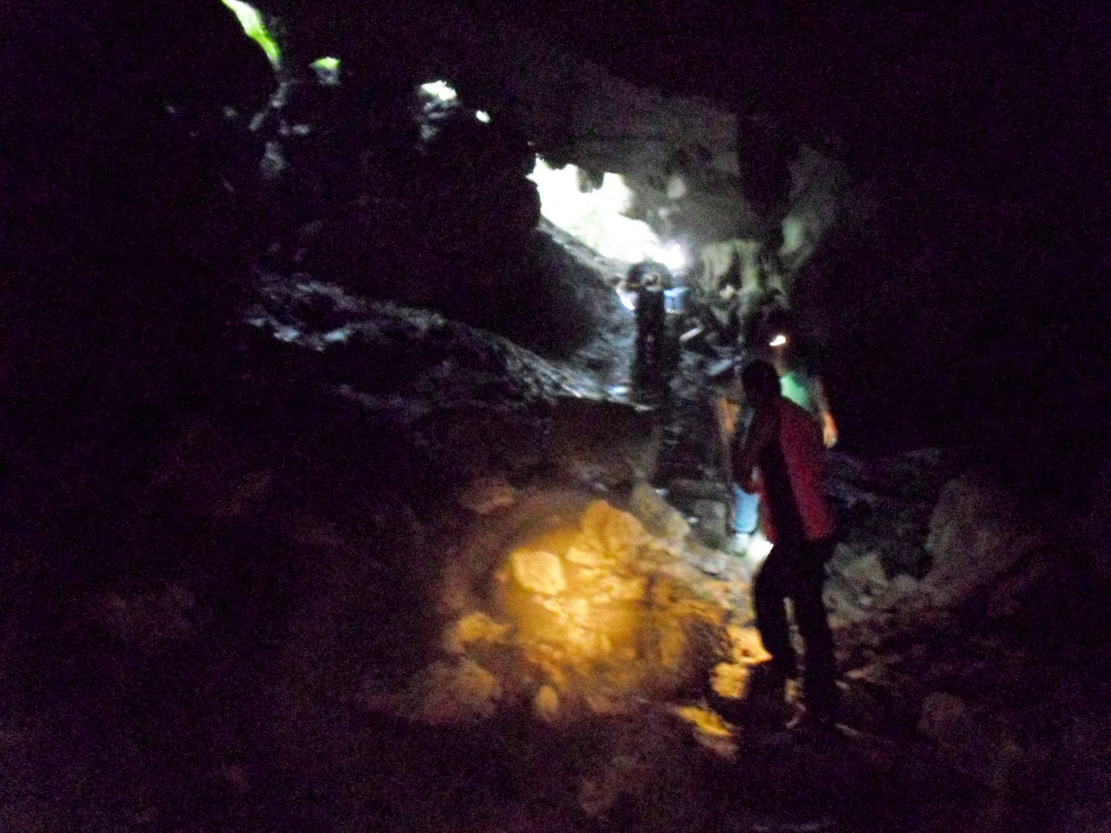
Even the entrance to the cave was spectacular. And muddy.
We slowly descend into the darkness, our six tiny flashlights painting fleeting spots of light on the cave walls. Damn, this is really, really incredible. Yes, I've been in stalactite caves before, but they were all.. civilized. 
They had a small hut with a cashier in front, loads of postcards from professional photographers, and little walkways with safety handrails and a thousand "warning: don't touch, eat, breath, or think." signs all over the place.

Stalactites in all sizes and colours.
This cave here is... wild. I realize we aren't the first people in this cave, but that's very easy to forget. (The guides confirm: just two months ago, they showed the cave to some French tourists. They were amazed as well.) I can feel a slight breeze, the air is cold and fresh. From somewhere far away the roar of an underground river is audible. If the invisible giant cave toad decides to eat us now, it will be weeks until someone finds out what happened. The limestone structures around us are hued yellow, red, pink, orange and brown. If someone slips and breaks a leg now, we do have a serious problem. The shapes vary from sponge-like (but still limestone deposits) to knifeblade-thin, and in between the stalactites vary from grotesque to eerie.

And weird limestone things that look like they were designed by H.R. Giger.
This cave is bloody real.
The intrepid cave explorers. With very weak lights. And bad cameras. It's fun nevertheless.
I'm exhausted when we arrive in Tuxtla in the night.

Day Three:
Today, we want to start with the official tourist program. The Cañón del Sumidero, one of the few of Chiapa's sights that are "developed". After the adventures of the past few days, it's a bit like a slap in the face.
For a few pesos, a small boy that probably should be in school shows us the way to a boat company with "good price". There we do pay a reasonable price, and get into the line behind some (other) European and US-American tourists that should please put on some more clothes. Gratefully I accept an ice-cold beer from Ivan's magic bag.

Getting ready to explore the canyon. Life vests are mandatory.
We get into the boat, and I stop bitching. The engine whips the small vessel up the river, while the banks at both sides slowly come closer and the rocks grow steeper.

Looks like the vultures want to show off.
Soon we fly into mouth of the canyon, and I have to crane back my neck a lot to be able see the edge. The cliff edges to the left and right of the river rise over a thousand meters high, almost vertically. I don't know if there's rock climbers around, but if there are, they will definitely be exhausted but happy.

Crocodile! This guy looks like it is fake or photoshopped onto that stone, but it doesn't care about that. Actually, it rip anyone apart and eat them who says "fake!" too close to it.
The boat drivers brings the vessel to a stop close to some of the "main" attractions. The crocodiles are definitely one, and unlike us, they stay utterly unimpressed. The first one blinks at us with the kind of patience that seems to say "My kind has been around here for a few million years more than you weird hairless monkeys, and now I'll just wait a few million years more until you are gone, to have my peace." I hope the crocodile is right.

Some kilometers further I see that there ARE climbers: Two tiny dots in orange working clothes are visible on top of the "Arbol de navidad" formation. Aparently, something has blocked the water flow of the underground river jetting into the canyon, where it creates this bizarre structure. The men work on unblocking the river, and, on top of that, add a scale to this sight, show just how enormous it is.


The "Christmas Tree" rock/vegetation formation. If you manage to spot the restauration worker in the orange overall near the top, you will get a clear idea how huge this is.
The boat continues until we pass the canyon, and reach an extensive lake, surrounded by mostly untouched djungle. The driver holds a short speech, explains about the hydroelectric power plant close by that provides most of Chiapas with clean energy, and thanks us for the tips we are about to give him. Then another, slower and wider boat comes along. Turns out it's the "bar boat", and they sell crisps, fresh fruit and vegetables to nibble (complete with chili sauce, of course), and Micheladas. Mexicans are wonderfully imaginative once they get their tourism started.

After the boat tour, Ivan drives a few kilometers out of Chiapas de Corzo, and stops at a small parking lot, in front of the El Correadero waterfall. Obviously, this is not a main attraction any more, because we pay only 20 pesos entrance fee.
Just a few steps further we meet a group of around 10 people. All of them wear wetsuits, climbing gear, helmets with flashlights, and huge great grins in their face.
Looks like they just climbed into (and back out of) an underground river, and enjoyed it a lot. (If you ever come to Chiapas, try to do that! And tell me about it!)
On our way to the Cascada El Correadero.

What looks like science-fiction art installations actually just grows here.

We "just" climb the stairs to reach the top of the waterfall, and proceed into the cave mouth. A small rock pool in the cristal clear (and not even terribly cold) water invites us for a swim.

Rock pool at the cave entrance over the waterfall.

View from the top of the waterfall towards the "natural jacuzzis".

As a grand finale, Ivan takes us a place that he calls "one of his favourite seafood places". It's actually just a dusty parking lot between two featureless houses, where they sell stuff from atop of a pick-up. But my goodness, what stuff! A platefull of Blue Crab meat, a pile of those marinated shrimps, and a small portion of fish eggs later we float in Maritime Gourmets' heaven. (Okay, I feel a bit queasy about eating fishes ovaries, but the rest is incredibly yummy.)

On the next day, we return to San Cristobal de las Casas. We just spent three days in (or mostly: around) Tuxtla, but what three days! Ivan, thank you very much, we really had an amzing time!

Donnerstag, 25. Dezember 2014

Misol-Ha & Agua Azul

Und der Bus bringt uns zu Misol-Ha, einem Wasserfall etwa 30 Kilometer weiter. Aufgrund von Regenfällen, die vor ein paar Tagen niedergegangen sind, führt der Fluss gerade SEHR viel Wasser.
Der Weg, der hinter dem Wasserfall vorbeiführt, ist teilweise begehbar. Aber schon aus etlichen Metern Entfernung spürt man den Sprühnebel, und ein paar nässeverachtende Touristen wagen sich tatsächlich direkt hinter den Wasserfall. Die meisten halten es ca. dreißig Sekunden aus, genug um ein einzelnes Photo zu schießen. Danach kehren sie tropfnass zurück, und wirken, als wären sie in eine Badewanne gesprungen. 
Angesichts des überwältigenden Naturschauspiels muss man nicht gut angezogen sein.
Natürlich gibt es auch hier ein auf Touristen getrimmtes (sprich: teures) Restaurant. Mir werden gut zwei Drittel unserer Mitfahrer spontan sympatischer, weil sie genau wie wir ein transportables Mittagessen eingepackt haben.

Man hört ja immer wieder (nicht täglich, aber doch..), dass herabfallende Kokosnüsse global gesehen eine tödlichere Gefahr darstellen als Hai-Attacken. Aber was ist mit herabfallenden Palmwedeln? Der hier sieht auch nicht gerade wie etwas aus, das ich an den Kopf kriegen möchte.
Und dann zieht die Karawane weiter zum Agua Azul. Die Regenfälle haben auch diesen Fluss anschwellen lassen, und aus dem blauen Wasser ist ein Agua Marrón geworden. Trotzdem ist der Spaziergang an dieser Wasserfall-und -fällchen-Landschaft entlang wirklich schön.

Einmal mehr denke ich mir, dass man sich mehr Zeit hierfür nehmen sollte.

Agua Azul, hier gerade recht marrón.

Und nochmal: man stumpft zwar ab, aber die Flora hier ist beinah überall umwerfend.
Ein kleines Detail am Rande, das ich an dieser Stelle festhalten möchte: Mir gefällt der mexikanische Umgang mit Gefahren. Im Gegensatz zu (Mittel- und West-) Europa, oder noch krasser, den USA, wird hier davon ausgegangen, dass man mitdenkt. 
Zuhause muss man sich im öffentlichen Raum schon wirklich Mühe geben, wenn man sich wehtun möchte. Tausende von Warnschildern und Hinweistäfelchen, Sicherheitsabsperrungen und Geländern, elektrischen, elektronischen und vielleicht sogar virtuellen Hilfeinrichtungen bewahren einen davor, etwas Unüberlegtes zu tun, bei dem man selbst oder (Gott behüte!) fremdes Eigentum zu Schaden kommen könnte.
Und wenn man es doch schafft, kann man bestimmt jemanden verklagen, was darauf hinausläuft, dass noch ein paar weitere Warnschilder aufgestellt werden.

Das ganze führt meiner Meinung nach dazu, dass wir dazu erzogen werden, unüberlegt und blöd durch die Gegend zu laufen, weil.. es ist ja eh wurscht. Bevor was passiert, springt uns eine Sicherheitsvorkehrung an.

Hier ist das nicht so. Kurzes Beispiel: Das Loch in der Straße, an dem wir vorbeigekommen sind, ist geschätzte zwei bis drei Meter tief. Und die Sicherung sieht so aus:

Tiefes Loch mit völlig ausreichenden Sicherheitsvorkehrungen.
Ein Hoch auf den mexikanischen Ansatz zur Erziehung zur Verantwortlichkeit! Augen auf, Ohren auf, mitdenken! Es ist hilfreich, nützlich, und (zumindest hier) auch notwendig.

Palenque

Nach einer mehrstündigen Busfahrt von Mérida kommen wir dann in Palenque an. Wie gehabt werden auch in diesem Bus DVDs auf mehreren Bildschirmen gezeigt, diesmal ein Science-Fiction-Actionfilm mit erstaunlich brutalen Szenen, mit dem vermutlich die reisenden Kinder auf eine dystopische Zukunft vorbereitet werden sollen. Zum Glück funktionieren unsere Kopfhörer noch, und wenn man sich konzentriert, schafft man es, überwiegend aus dem Fenster und nicht auf den blöden Bildschirm zu starren.
Neu ist, dass der Bus einige Male angehalten wird, und ein Polizeibeamte sämtlich Pässe kontrolliert.

In Palenque angekommen, finden wir ein kleines Städtchen, das eifrig damit beschäftigt ist, sich für den zunehmenden Touristenstrom hübsch zu machen. So ziemlich alle Straßen der Innenstadt sind aufgerissen und werden gerade neu gepflastert, und auch die Hotels und Hostels putzen sich heraus.

Unser ursprünglicher Plan war, einige Tage hierzubleiben, und dann gemütlich die diversen Sehenwürdigkeiten in der Umgebung abzuklappern. Doch ein Guide auf der Straße überredet uns zu einer anderen Tour: 
Er bietet Shuttle-Fahrten zu den Ruinen von Palenque, zu Misol-Ha und Agua Azul (dazu später mehr) und schließlich nach San Cristobal de las Casas an. Das ganze für nur unwesentlich mehr Pesitos, also der offizielle 1.-Klasse-Bus ohnehin kosten würde. Und zu unserem leidwesen gibt es auf dieser Strecke nur erste Klasse (d.h. zu viel Airconditioning und zu viele DVDs.)

Also gut, wir probierens mal mit dem Touristenprogramm. Das Hostel ist ohnehin nicht all zu gemütlich: Wir dürfen zwar die Küche verwenden, aber ein großes Schild prangt über dem Herd: "Bitte verzichten Sie beim Kochen auf folgende Zutaten: Fisch, Knoblauch, Zwiebel, Alles was gut schmeckt aber Leute mit einem pervertierten Geruchssinn als störend empfinden könnten."
Zugegeben, ich habe die Aufschrift nur sinngemäß wiedergegeben, aber trotzdem war es nicht sympathisch.
Deshalb beschränkt sich unsere Kenntnis des Ortes Palenque auf das, was wir bei einem abendlichen Spaziergang sehen. Lieber Ort, wenn wir dir unrecht tun, tut mir das wirklich leid, aber wir waren wirklich nicht sehr begeistert von dir.

Gleich um 7 Uhr am nächsten Morgen geht dann die Tour los. Mit etwa 10 anderen Backpackern steigen wir in den Kleinbus, und nach kurzer Fahrt kommen wir bei den Ruinen von Palenque an. Um diese Uhrzeit ists noch ruhig, und sämtliche Verkäufer von teilweise wirklich sehr hübschem Tand sind noch leicht verschlafen dabei, ihre Waren auszurollen. Dann sind wir endlich in der archäologischen Ausgrabungsstädte:
Namensgebender Stuck am "Tempel des Schädels".
Auch diese "vorkolumbianische" Stadt gehört zum UNESCO-Weltkulturerbe. Noch beeindruckender finden wir schon nach den ersten Schritten, dass Archäologen schätzen, dass erst etwa fünf Prozent der Siedlung freigelegt sind. Und diese 5 Prozent sind schon enorm! Der ganz Rest schlummert noch unter unberührtem Dschungel.. Wer weiß, was sich da noch alles verbirgt.
Der "Tempel der Inschriften" wird gerade restauriert. Wenn man den Arbeitern eine Weile zusieht, wird einem schnell klar, dass man als Archäologe über eine ganz eigene Dimension von Geduld verfügen sollte.
Der Palast ist ein rießengroßer, ausgedehnter Gebäudekomplex, von dem noch ziemlich viel erhalten ist. Nicht nur eine Vielzahl von erhaltenem Stuck-Schmuck, sondern auch noch Gänge, Treppchen, Innenhöfe und ein Turm.
Einer der unzähligen Gänge/Räume/Sonstiges, in denen man sich im Palast verlaufen kann.
Genug jedenfalls, um sich darin zu verlaufen. Immer wieder stoßen wir wieder auf einen weiteren Raum, einen weiteren Innenhof, viele davon mit erläuternden Plaketten versehen.
Der Weiße Turm. Praktisch Weißes Haus von Palenque. Der Rest dürfte in knalligeren Farben gehalten gewesen sein.

Stucco an einer Säule eines Innenhofes des Palastes. Dargestellt ist irgendein Gott, dessen Namen ich vergessen habe.
Eine erstaunlich hohe Anzahl der alten Inschriften beschäftigt sich damit, wer zu welchem Anlass wie geopfert wurde. Meist zu Ehren des Herrschers, der sich den Palast eingerichtet hat, ein gewisser Herr K'inich Janaab' Pakal.

Was mir besonders gut gefallen hat, ist die ehemalige Krönungskammer. Die Mauern des eindrucksvollen Saales sind noch gut erhalten, und der mächtige Herrscher der Stadt hat sich bei der Innendekoration für ein besonders martialisches Motiv entschieden: 
Handgemalte Blümchentapeten.
Blümchentapeten im Krönungssaal.
Vom Palast aus sieht man auch noch einmal auf den Tempel der Inschriften.
Die Arbeiter auf der Pyramide erinnern mich ein wenig an das berühmt Photo aus New York:
Mittagspause für den Restaurierungstrupp.
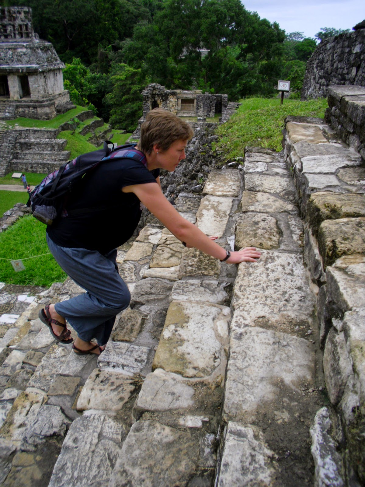
Es liegt die Vermutung nahe, dass die damalige Maya-Bevölkerung im Schnitt weit kleiner war als der heutige Durchschnittseuropäer. Es verwundert uns deshalb immer wieder, warum die Stufen (und es gibt davon wirklich viele!) dann so dermaßen hoch sind!
Steile Stufen führen auf den "Tempel des Kreuzes".

Aussicht vom Tempel des Kreuzes auf zwei weitere kleinere Tempelchen sowie den Palast-Komplex.
Der Aufstieg lohnt sich aber jedes Mal. Wir haben insgesamt vier Stunden zur Verfügung, um die Ausgrabungsstätte zu erkunden, aber das reicht, ganz ehrlich, absolut nicht aus. Das Gelände ist weitläufig, steil, und an jeder Ecke verbirgt sich noch irgendein neues, sehenswürdiges Detail. Manchmal sind es keine Stein-Strukturen:

Auch die Pflanzenwelt fürchtet sich nicht vor intensiven Farben. Rot-orange (Blüten?-)Blätter, kleine weiße und ultramarinblaue Beeren. Weiß irgendjemand, was das ist?
Am Ende bleibt uns noch etwa eine Stunde, um das in der Nähe eingerichtete Museum zu bestaunen, auch wenn wir von den ganzen Eindrücken schon ein wenig ermüdet sind. Geschieht uns recht, denk ich mir ein paar Mal, man sollte sowas nicht mit einer Wir-nehmen-jede-Sehenswürdigkeit-am-Weg-mit-Schneller-jetzt!-Tour machen.
Eine der Ton-Skulpturen im Museum.
Bleibt nur noch zu erwähnen, dass der Weg zum Museum einen steilen kleinen Pfad hinabführt, der über Treppchen und eine Hängebrücke auch an einem spektakulären Wasserfall vorbeiführt.
Meine Güte, mehrere Tage, ein dicker Stapel Literatur und jemand, der sich hier wirklich gut auskennt wären eigentlich nötig, um hier alles zu erkunden.

Unser Bus kommt.

Map - Route in Cuba

With a bit of delay, I also did a sketch of our route in Cuba.


Once again: if you have to chance, go there. As soon as possible.

Map - Route in Mexico

Since I'm sure I will forget the route at some point, I tried (again) to embed a map:


This time it looks like it's working properly. And anyone with a fast enough computer at hand (not me, at least right now) can even zoom around and stuff.

Sonntag, 21. Dezember 2014

Campeche


Actually, the city's name is San Francisco de Campeche, since it's from the times when you just had to have a Saint caring for your city. It used to be the main port of the Spaniards in Yucatán, and every single pirate sailing in the Caribbean passed by at least once. Usually, they did not just stop to have a cup of chocolate or similar beverage, but tried to sack it. 
San Francisco didn't do a very good job at protecting the city, so at some point, the (surviving) people got fed up with pirate attacks, and built themselves eight massive forts, connected by sturdy city walls. 
And that's how the city got itself the status of UNESCO World Heritage Site.

Looks like the Spanish soldiers defending the city weren't very tall. Still, they somehow managed to beat off most pirate attacks after the fortifications had been completed.
 In Celestún, we learn that there is no direct way towards the south. So we take a bus to Mérida, get off at the wrong stop, walk halfway across the city to the correct bus terminal, and are finally on our five-hour drive towards Campeche.

So we arrive in Campeche in the late afternoon, and a short taxi ride brings us to the city centre. A hostel (the "Monkey Hostel", a lot more quiet than the name suggests) is easily found, and immediately after dumping our backpacks, we set out to explore.
The colonial city centre is, of course, very nicely restored. It seems that a lot of the money goes into bright paint: Every single facade is tinted in another garish colour. We do find a way to pass the city walls and reach the malecon, but can't help to feel slightly disappointed. The sunset is hidden by clouds, and the seafront can't keep up with the ones in Cuba (okay, I admit it: we are already really spoilt). Still, it's a nice walk. 
On our way back, we randomly meet a guy that works for the Mexican state statistics office, and learn a few interesting facts about Yucatán. (Lowest crime rate of Mexico, and highest suicide rate. Some more input, but it does not help me to form a coherent picture of the area.)

On the next day, we decide to inspect the historic sights of the city a bit closer. It turns out that you can walk on top of the most parts of the city wall.

The brightly painted house facades reflecting bright sunshine onto the whitewashed city wall.
And, I'm excited to learn, some enthusiastic people have created a small but interesting pirate museum in one of the old fort.
To be very honest, it's not a big thing, just three rooms with many tableaus (only in Spanish), some reproductions of ancient city maps, and very few exhibits, mostly handguns and swords used by/against the pirates, but.. Arrrrr, I love it!
  
For instance, I did not know before that pirate came in four distinct flavours: pirates (classical "I refuse to fit in the system, give me your gold, Spaniard, arrr, or I'll rip out yer throat" guys with a truly inspiring Anarchistic approach to property), buccaneers (pretty much the same, but usually better equipped, more manpower, more ships, and more prone to attack fortified coastal towns), and corsairs and freebooters (both sailing for one or the other government, usually trying to weaken the Spanish).
However, I have found out (after reading up a bit on the topic), even those four designations lack precise definitions, and are often mixed up. But on my pirate cruise through the internet, I've found some etymological treasures:
For example, "freebooter" comes from the Dutch word "frij buiter", meaning "free boat-er" or, to be a bit more poetic, "guy with a boat being wild and free." It translated into German "Freibeuter", French "filibustier" (long way here..), and Spanish "filibustero" (looks like they talked with the French about the blasted frijbuiters...).
Banderas Piratas, pirate flags, used by the guys who burnt and plundered Campeche, and their colleagues.
Okay, I will refrain from rhapsodizing more about pirates and return to Campeche. We also find the local fruit and food market (as always worth it!), and a botanical garden (also in one of the old fortifications. It's a small place, but a nice, calm spot, so we spend a long time there, a lot longer than it takes to see all the trees, bushes and flowers.)

We also visited one of the old gate houses (not containing any plants or pirated, but the lady in the picture below.)

From left to right: Young lady with traveller's outfit, older lady with typical dress from the region.
On our last evening in the town we meet a couchsurfer for a couple of beers. Daniel is a marine biologist, and a really nice guy. We learn the answers to a lot of our questions (okay, some of them didn't come to our mind before we met him): 
  • One of the things marine biologists do is monitor the population of certain sea creatures, and help to set reasonable fishing limits in case the populations are found to be too low. (In this case, Daniel is the specialist for shrimps.)
  • Sea cucumbers are fished in the Caribbean in large quantities and exported to Asia, where they are considered a delicacy. However, the preparation of the dish is time-consuming and complicated.
  • I always thought they look like poo on the bottom of the ocean, but they are really aquatic earthworms, meaning they are tremendiously important for the ecology of the sea bottom. They eat and filter a huge quantity of sand each day.
  • On the topic of exotic food: I also learned that I do not like the Mexican cow stomach soup, and eliminated the name for it from my memory.
  • Flamingoes taste like chicken. 
  • Also, they are highly endangered, and are only eaten by this marine biologist because he got a dead one from a local fisherman.
  • Said fisherman shoots flamingoes very rarely, and doesn't eat them. He just uses the pink feathers to make fly-fishing bait.
  • One flamingo has enough feathers for a lot of bait.
Aaand a lot more! Campeche was pretty to see, but wouldn't have been half as interesting without this Couchsurfing meeting.

Donnerstag, 11. Dezember 2014

Celestún

Von Mérida aus machen wir einen Abstecher nach Celestún. Das ist ein wirklich kleiner Fischerort, der mitten in einem Naturschutzgebiet liegt. So langsam hält auch dort der Tourismus Einzug, denn die Bootstouren sind inzwischen nicht mehr nur bei mexikanischen Ausflüglern bekannt.
Oh stimmt.. wir sind ja noch immer im Orient von Mexico.

Bei unserer Ankunft stellen wir fest, dass das einzige Hostel im Ort inzwischen geschlossen ist. Zum Glück gibts daneben ein beinahe geschlossenes Hotel. (Der Innenhof wird aus unerfindlichen Gründen als Lager für alte Kühlschränke verwendet..) Und es gibt keine Räume mit Klimaanlage, nur einfache Ventilatoren. Juhu!
Eine der offiziellen Sehenswürdigkeiten: der alte und der neue Leuchtturm

Schon auf unserem ersten Spaziergang sehen wir einige der Wasservögel, für die das Dorf bekannt ist. 

Noch begeisterterter sind wird, als wir eine ganze Schar von Braunpelikanen beim Fischen direkt neben einem Pier am Meer beobachten können. Die behäbig wirkenden Tiere fliegen dazu erstaunlich rasch auf, drehen sich dann in einen wohl gewollten, aber trotzdem nach Turbulenzen aussehenden Sturzflug, und klatschen mit dem Schnabel voran ins Wasser, während sie wie wild mit den Füßen paddeln. 
Wenn sie dann wieder gemütlich auf der Wasseroberfläche dahintreiben, haben sie den gesamten Kehlsack prall voll mit Wasser, plus dem einen Fisch, den sie schon aus der Luft gesehen und gejagt haben. Der Kehlsack übernimmt dann die Funktion eines Siebes, und schon nach kurzem wird der abgeseihte Fisch geschluckt. Diese Operation wird nur beliebig oft wiederholt.
Begeistert rohen Fisch schluckender Braunpelikan.
Hier am Strand entstand auch unser auf Facebook berühmt gewordenes "Clamato-Juice-Bier"-Photo. Der Strand und der Sonnenuntergang trösten aber darüber hinweg.
Zum Baden etwas zu kühl, aber trotzdem schön.
"They lack a lot of infrastructure, but they DO have the best sunsets there."
Am nächsten Tag leisten wir uns wirklich das volle Touristenprogramm: Mit dem Boot die Halbinsel südlich von Celestún entlang, erst mal bis zur Einfahrt zum Fischerhafen.
Zwischen Kormoranen und Braunpelikanen finden sich hin und wieder auch (vermutlich) Nashorn-Pelikane. Die leben eigentlich in Kanada und überwintern hier. Viele kanadische Pensionistinnen und Pensionisten ahmen dieses Verhalten inzwischen nach.
 Einige Minuten später kommen wir dann auch schon zum ersten Flamingo-Strand.
Flamingos und unberührte Halbinsel. Hier gibts zum Glück keine einzige Straße.
Unser Bootsmann erklärt routiniert die Lebensgewohnheiten von Flamingos, und natürlich auch, dass die rosa Färbung von den diversen Krebstierchen stammt, die die Vögel fressen. Logisch, aber von mir bisher noch nicht beobachtet, ist natürlich, dass die Jungtiere dann anders aussehen müssen. Es zeigt sich, dass sie ähnlich wie junge Schwäne grau, flauschig, und ein bisschen daneben aussehen.

Graues Flamingo-Jungtier, pinker, möglicherweise stolz spazierender Flamingo-Elternteil, sowie unbekannter weißer Nachahmer, der nur so tut.
Die Tour geht weiter um die Halbinsel herum, in die Lagune. Das Wasser hat eine seltsame bräunliche Färbung, die laut unserem Guide von den Mangroven stammt. Die Erklärung erscheint mir ungenügend, und denke mir im Stillen, dass da wohl bei der Übersetzung was verlorengegangen ist..
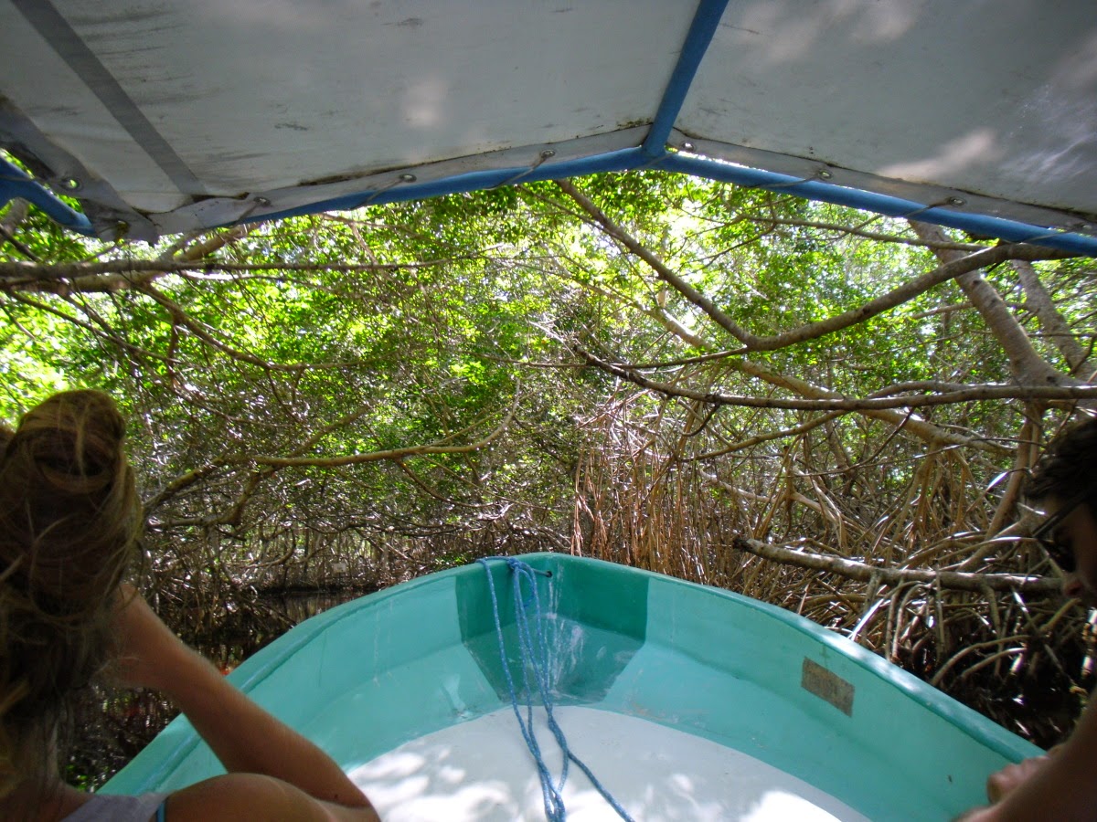
Der Steuermann dreht dann das Boot, und steuert es mit unverminderter Geschwindigkeit auf ein Mangrovendickicht zu. Statt zu bremsen, grinst er nur, und im allerletzen Moment tut sich vor uns ein Tunnel auf, in den das Boot hineinschießt. 

Hier fährt der Gute endlich langsamer.. 
Und die Welt verändert sich sofort. Die Luft wirklich noch viel frischer als draußen am Meer, und.. tatsächlich! das Wasser ist komplett rot gefärbt. Der Bootsmann holt zu einer detaillierteren Erklärung aus, die Farbe dürfte etwas mit der Tannin-haltigen Rinde von einigen der Mangroven-Bäumen zu tun haben. Und auch die Luft ist den CO2-hungrigen Pflanzen zu verdanken: Angeblich ist die Sauerstoff-Konzentration hier messbar höher.

Sehr sehr eigenartig.
Den letzten Tag verbringen wir am Strand spazierend. Der Fischerhafen besteht aus einem erstaunlich großen Hafenbecken mit vielen wirklich kleinen Booten, auf denen jeweils allerhöchstens 3 oder 4 Fischer Platz haben. Es wird also wirklich nur für den lokalen Markt gefangen. 
Wir sind leider zu spät dran, und sehen nur mehr einige improvisierte, aber leere Hallen, ganz ohne Fisch. 

Um so freudiger überrascht sind wir am Rückweg, als wir in einem kleinen Restaurant zu unserem Bier nicht gewöhnliche Knabbereien serviert bekommen, sondern gleich mal einen Teller voll Shrimps. Das zweite Bier (Anmerkung an mitlesende Eltern: In Mexiko werden nur kleine Biere (300 ml) serviert! Wir dürften deshalb mehr als eines trinken. ;) ) kommt dann mit einer kleinen Portion faschiertem Fischfleisch, zubereitet mit Tomaten, etwas Zwiebel und dem unvermeidlichen Chili. 
Ein freundlicher Mexikaner vom Nebentisch, der offensichtlich erfreut ist, sein ziemlich gutes Englisch zu praktizieren, stellt sich als einer der Touristen-Boots-Fahrer vor, und erklärt uns, dass wir gerade ein hier ganz traditionelles Gericht aus Rochen gegessen haben. Und weil man das hier so macht (sagt er) stellt er uns gleich noch einen Teller mit "Blue crab" hin, also frittierten Krebsen... die wirklich gut sind!
Ich glaube, wir unterhalten inzwischen einen beachtlichen Prozentsatz der Gäste, die sich sichtlich über unsere Versuche freuen, manos de cangrejo (Krabbenscheren) korrekt zu essen: Schere nehmen, an die Tischkante halten, mit der Bierflasche draufschlagen, Fleisch herauszutzeln. 
Nach einem frittierten Fisch (den wir sogar selbst bestellen!) stellt sich heraus, dass es noch einer Zubereitungsart von Garnelen gibt, die wir nicht kennen. Das darf nicht sein! Und schwups, stellt der Gute noch einen Teller auf unseren Tisch. Moment, wenn wir blue crab noch gar nicht kannten, können wir ja auch blue crab in Butter und Knoblauch nicht kennen.. das muss geändert werden! Die in Salz getrockneten und in Limettensaft marinierten Shrimps, die schmecken uns auch? Wie, die kennen wir nicht? Oh nein! Schnell ein Teller auf unseren Tisch...

Kurz bevor wir in ein tiefes Eiweiß-induziertes Koma fallen, schaffen wir es, uns zu bedanken und zu verabschieden. Der Weg ins Hotel mit so vollem Bauch erscheint fürchterlich weit, aber wir schaffens irgendwie doch.
Mangrovenwald mit zwei Menschen, einer Million Termiten und noch mehr Moskitos.
Wir empfehlen seither übrigens allen Reisenden, denen wir begegnen, auch ein paar Tage in Celestún zu verbringen.